知床しれとこ
Shiretoko
the northeastern peninsula where drift ice reaches its southern limit
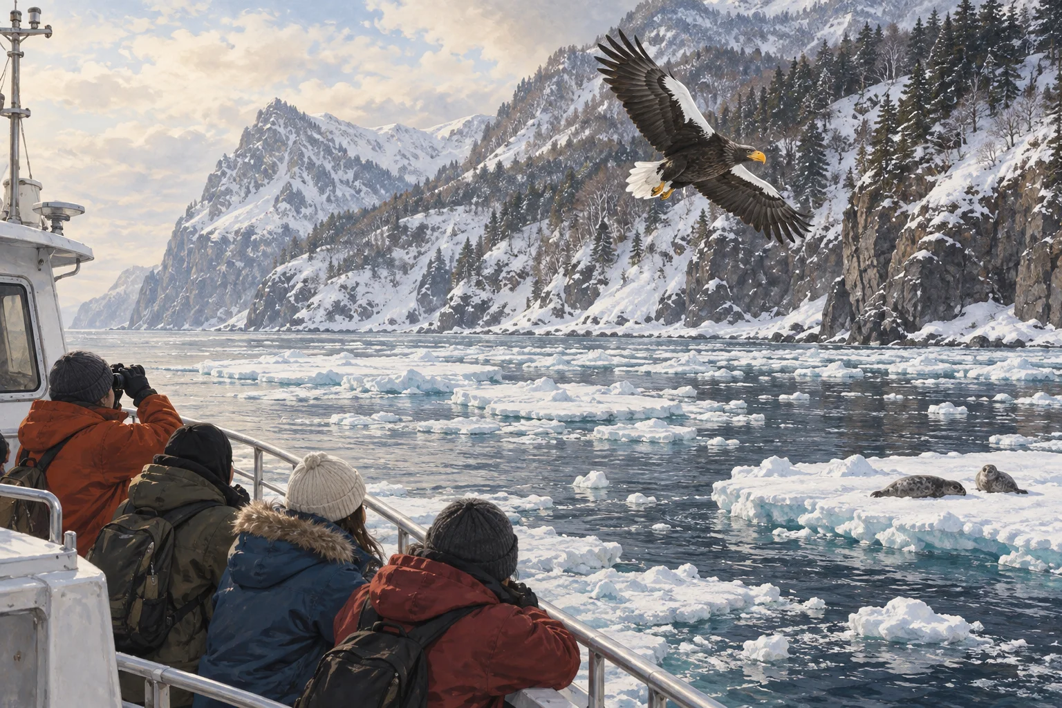
名はアイヌ語で「地の果て」。冬、北半球で流氷が来る南限とされる海。
一言で言うと
これだけ覚えれば最低限伝わる一文
Shiretoko is a wild peninsula in northeast Hokkaido where sea ice arrives every winter.
知床は北海道の北東にある手つかずの半島で、毎年冬に流氷が着きます。
30秒で説明する
外国人に説明するときの標準サイズ
Shiretoko is a narrow peninsula reaching into the Sea of Okhotsk at the northeast corner of Hokkaido. Its name comes from the Ainu words for the end of the earth. Drift ice arrives here each winter, at what is described as its southern limit in the Northern Hemisphere, and the nutrients it carries feed everything from plankton to salmon to brown bears. It became a natural World Heritage site in 2005.
知床は北海道の北東の端から、オホーツク海へ細く突き出した半島です。名はアイヌ語で「地の果て」を意味する言葉に由来します。冬には流氷が着きます。北半球で流氷が届く南限とされる海で、流氷が運ぶ栄養がプランクトンからサケ、ヒグマまでを支えます。2005年に世界自然遺産になりました。
スピーチ・英作文
通訳案内士の二次口述・大学入試の自由英作文に
Shiretoko is the northeastern tip of Hokkaido, a narrow mountainous peninsula with no road along much of it. The name comes from Ainu, meaning roughly the place where the land ends. What makes it ecologically remarkable is the ice.
Every winter drift ice comes down from the Amur river region and reaches this coast, which is usually described as the southern limit of drift ice in the Northern Hemisphere. Algae grow on the underside of that ice, and when it melts in spring the water is unusually rich, which feeds plankton, then fish, then salmon returning up the rivers, then brown bears and eagles.
It was listed as a natural World Heritage site in 2005 specifically for that link between sea and land. The bear density here is among the highest in the world, so you walk with a guide or on raised boardwalks, and you do not go quietly around corners.
知床は北海道の北東の先で、細く険しい半島です。大部分に道はありません。名はアイヌ語で、およそ「大地の果てるところ」という意味です。生態の上でこの土地が際立っているのは、氷のためです。
毎年冬、アムール川のあたりから流氷が下りてきてこの海岸に届きます。北半球の流氷の南限とされる場所です。氷の裏には藻が育ち、春に融けると海が異様に豊かになります。それがプランクトンを、魚を、川をのぼるサケを、そしてヒグマとワシを養います。
2005年、海と陸のこのつながりが評価されて世界自然遺産になりました。ヒグマの生息密度は世界でも最上位とされるので、歩くときはガイドとともに、あるいは高架の木道を使い、曲がり角を黙って回らないようにします。
こう聞かれたら
外国人から実際にされる質問と、その答え方。
Can you walk on the drift ice?
流氷の上を歩けるのですか。
There are guided walks in a dry suit in February and March, where you float and crawl among the floes. On your own it would be extremely dangerous, since the ice moves with wind and current.
2月から3月に、ドライスーツを着てガイドと歩く体験があります。氷のあいだを浮いたり這ったりします。自分だけでは極めて危険です。氷は風と潮で動きます。
Will I see a bear?
ヒグマを見られますか。
Quite possibly, from a boat along the coast, where bears come down to the shore. On land you are more likely to see signs of them than the animal itself, which is the preferable outcome.
海岸沿いの船からなら、十分あり得ます。ヒグマは浜まで下りてきます。陸では、姿より痕跡を見ることのほうが多いでしょう。そのほうが望ましい結果です。
What does the Ainu connection mean here?
ここでのアイヌとのつながりは、どういう意味を持つのですか。
Many place names in Hokkaido, including this one, are Ainu words written with Japanese characters chosen for sound. The Ainu are the indigenous people of the north, recognized as such by law in 2019.
北海道の地名の多くは、この名も含めてアイヌ語を音に合わせて漢字にしたものです。アイヌは北の先住民族で、2019年の法律で先住民族と明記されました。
そのまま使えるフレーズ
- The name is Ainu for the end of the earth.名はアイヌ語で「地の果て」という意味です。
- Drift ice comes here every winter.毎年冬に流氷が来ます。
- This is said to be the southernmost sea in the Northern Hemisphere that drift ice reaches.ここは北半球で流氷が届くいちばん南の海とされています。
- The ice is what makes the sea here so rich.この海が豊かなのは、氷のおかげです。
- Walk with a guide — this is bear country.ガイドと歩いてください。ヒグマのいる土地です。
説明に使う語句
- drift ice, sea ice流氷
- brown bearヒグマ
- peninsula半島
- food chain食物連鎖
- indigenous people先住民族
動画で見る
YouTube より豆知識
知床はアイヌ語の「シリエトク」(地の果て、大地の突端)に由来するとされる。2005年、海と陸の生態系のつながりが評価されて世界自然遺産に登録された。オホーツク海の流氷は北半球における流氷の南限とされ、氷の下に育つアイスアルジーが春の大増殖を支える。ヒグマの生息密度は世界でも最も高い水準とされ、半島全体で数百頭が暮らす。半島の先端部には道路がなく、船か徒歩でしか近づけない。
