川と橋かわとはし
kawa to hashi
Japan's short steep rivers
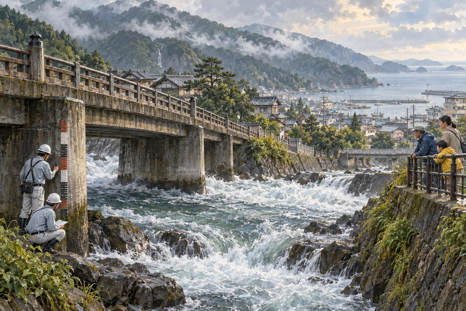
源流から河口まで数十キロ。急で短く、雨のたびに姿を変える川と、それを渡る橋の話。
一言で言うと
これだけ覚えれば最低限伝わる一文
Kawa to hashi, or rivers and bridges, are shaped by Japan's short, steep rivers, which rise and fall fast.
川と橋は、短く急で水かさが速く増減する日本の川の性質によって形づくられてきたものです。
30秒で説明する
外国人に説明するときの標準サイズ
Because Japan is a narrow country with mountains down its spine, rivers run only tens of kilometers from source to sea and drop steeply on the way. They can be a trickle over gravel one week and a brown torrent the next. This shapes everything around them: high concrete embankments, wide flood plains kept empty, warning sirens, and in the Edo period a lack of bridges on some major rivers, usually explained as a defense measure.
日本は細長く、背骨のように山が走っているので、川は水源から海まで数十キロしかなく、その間に急に落ちます。先週は砂利の上のせせらぎでも、翌週には茶色い激流になります。それが周りのすべてを形づくります。高いコンクリートの堤防、あえて空けてある広い河川敷、警報のサイレン、そして江戸時代に、防衛のためと説明されることの多い、一部の大きな川に橋を架けない方針です。
スピーチ・英作文
通訳案内士の二次口述・大学入試の自由英作文に
A European river wanders for hundreds of kilometers across a plain. A Japanese river falls off a mountain. The islands are narrow, with a mountain spine close to both coasts, so most rivers run only tens of kilometers from source to sea and lose their height quickly along the way. The consequences are everywhere once you look.
Riverbeds are wide and stony because the water needs room when it rises, and the flat land beside them is used for baseball grounds, bike paths and community gardens precisely because it is expected to flood. Embankments are high and often concrete, dams and weirs are numerous, and loudspeakers on poles warn people to leave the riverbank when rain is heavy upstream.
Bridges are correspondingly important, and their absence was once a policy: the Tokugawa government kept certain major rivers unbridged so that travelers had to be ferried or carried across, which is usually explained as a way to slow any army approaching Edo. Today those same crossings carry expressways, and the old post towns beside them are quiet.
ヨーロッパの川は平原を何百キロも蛇行します。日本の川は山から落ちてきます。列島は細く、山の背骨が両方の海岸に近いので、多くの川は水源から海まで数十キロしかなく、その間に高さを一気に失います。見方を知れば、その結果はどこにでも見えます。
河床が広く石だらけなのは、増えた水に場所が要るからです。そのそばの平らな土地が野球場やサイクリングロードや市民農園になっているのは、まさに水に浸かることが前提だからです。堤防は高く多くはコンクリートで、ダムや堰は数多く、上流で雨が強いと電柱のスピーカーが河川敷から離れるよう呼びかけます。
橋は当然ながら重要で、その不在はかつて政策でした。徳川の幕府は特定の大きな川に橋を架けず、旅人は渡し船や人足に頼るほかありませんでした。江戸へ向かう軍勢の足を鈍らせるためだったと、ふつう説明されます。今では同じ渡河点を高速道路が越え、そのそばの古い宿場町は静かです。
こう聞かれたら
外国人から実際にされる質問と、その答え方。
Why is the land beside rivers always empty?
どうして川沿いの土地はいつも空いているのですか。
It is the flood plain, left clear on purpose so the river has somewhere to go. Cities use it for sports grounds, paths and parking, all things that can be closed and cleaned after a flood. Notices tell you to leave when water rises, and barriers close the access roads.
河川敷で、川に逃げ場を与えるためにあえて空けてあります。都市はそこを運動場や道や駐車場に使います。どれも増水のあとに閉じて掃除できるものです。水位が上がれば退去を促す表示が出て、進入路は閉鎖されます。
Why were some rivers deliberately left without bridges?
どうして、わざと橋を架けなかった川があるのですか。
The usual explanation is defense: under the Tokugawa shogunate, keeping certain rivers on the main highways unbridged made it harder for a hostile force to move quickly toward Edo, though the difficulty of building on fast, flood-prone rivers is also cited. Travelers crossed by ferry or were carried by porters, which also created business for the post towns on each bank.
ふつうは防衛のためと説明されます。徳川の幕府のもとで、主要な街道の特定の川に橋を架けないことは、敵の軍勢が江戸へ速く進むことを難しくしました。ただ、流れが速く氾濫しやすい川に橋を架ける技術上の難しさも理由に挙げられます。旅人は渡し船か人足に頼って渡り、それが両岸の宿場町の商売にもなりました。
Is flooding still a serious problem?
水害はいまも深刻な問題ですか。
Yes. Heavy rain events cause levee breaches and inundation somewhere in the country most years, and municipalities publish hazard maps showing expected flood depth for every address. Checking the map for where you are staying is genuinely worth five minutes.
深刻です。大雨による堤防の決壊や浸水は、ほぼ毎年どこかで起きています。自治体は住所ごとの想定浸水深を示したハザードマップを公表しています。滞在先の地図を確かめるのは、五分かける価値が本当にあります。
そのまま使えるフレーズ
- Japanese rivers are short and steep.日本の川は短くて急です。
- That flat area is the flood plain.あの平らなところは河川敷です。
- The water rises very fast after rain.雨のあと水かさが急に増します。
- Check the hazard map for the area.その地域のハザードマップを確認してください。
- Some rivers had no bridges on purpose.わざと橋を架けなかった川もあります。
説明に使う語句
- riverbed河床・川原
- embankment / levee堤防
- flood plain河川敷
- flooding洪水・浸水
- hazard mapハザードマップ
- ferry crossing渡し
動画で見る
YouTube より豆知識
日本の川は、山地が海に近く国土が狭いため、延長が短く勾配が急という特徴があります。降雨のあと短時間で流量が増え、平常時との差が大きいことから、治水では堤防、遊水地、ダム、放水路などが組み合わせて整備されてきました。河川敷が運動場や散策路として使われるのは、増水時に水が広がる場所を確保しておく考え方によるものです。江戸時代には、東海道の大井川のように、橋を架けず、川越人足による渡河が行われた川がありました。理由は防衛上のためとされることが多いものの、架橋の技術的な難しさも指摘されています。明治以降、鉄道と道路の整備に伴って架橋が進みました。市町村はハザードマップを公表しており、想定される浸水の深さや避難場所を住所ごとに確認できます。
