hazado mappu
the map showing how bad flooding or a disaster could get at your address
ハザードマップ(はざーどまっぷ)
In one line
The shortest answer that works
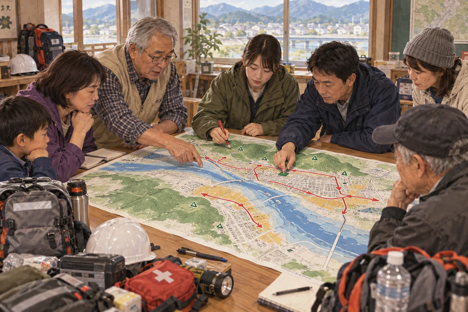
Hazado mappu, a hazard map, is a color-coded guide to how deep floods or other disasters could reach an address.
ハザードマップとは、その住所で洪水などの被害がどこまで及ぶかを色で示した地図です。
In 30 seconds
The standard explanation
Japanese municipalities in areas at risk are legally required to publish hazard maps showing where flooding, landslides, tsunami or volcanic ash could reach under a worst-case scenario, along with the designated evacuation shelter for that area. They're distributed to households, available at city offices, and available online by address. Real estate agents are now required to explain flood risk from the map to buyers and renters before a contract, which has made the maps part of ordinary house-hunting rather than only disaster planning.
危険のある地域の市区町村は、最悪の想定のもとで洪水や土砂災害、津波、火山灰などがどこまで及ぶかを示すハザードマップを作成し、その地域の指定避難所とあわせて公表する義務を法律で負っています。各世帯に配られ、役所でも印刷でき、住所からオンラインでも確認できます。不動産の仲介業者は、契約の前に地図をもとに水害リスクを買い手や借り手に説明することが義務づけられており、ハザードマップは防災の話にとどまらず、ふつうの物件探しの一部になっています。
As a short speech
A full paragraph you can read aloud
A hazard map, hazado mappu, is a color-coded map a Japanese municipality is required to make under laws such as the Flood Control Act, showing what would happen to a given neighborhood under the worst realistic flood, landslide, tsunami or volcanic scenario the government models, not just an average bad year. Deeper colors usually mean deeper expected floodwater, sometimes reaching the second floor of a house, and the map also marks the nearest designated evacuation shelter.
Every household in a covered area is supposed to receive a printed copy, and most maps are also searchable online by address. What changed the map's everyday relevance was a rule requiring real estate agents to explain flood risk from the hazard map to a buyer or renter before they sign, so checking it has become as routine as checking the neighborhood or the commute. It sounds abstract until you find your own address inside a deep-colored zone that was rice paddy a century ago.
ハザードマップは、日本の市区町村が水防法などの法律にもとづいて作成を義務づけられている色分けの地図で、平均的な悪い年ではなく、国が想定する現実的な最悪規模の洪水や土砂災害、津波、噴火が起きたとき、その地域がどうなるかを示します。色が濃いほど想定される浸水の深さは深く、場合によっては家の二階まで届くこともあり、地図には最寄りの指定避難所も記されています。
対象地域の各世帯には印刷された地図が配られるはずで、ほとんどの地図は住所から検索してオンラインでも見られます。この地図が暮らしに直接関わるようになったきっかけは、不動産の仲介業者が契約の前に、買い手や借り手にハザードマップにもとづく水害リスクを説明することが義務づけられたことです。
地域や通勤時間を確かめるのと同じくらい、地図を確認することが当たり前になりました。自分の住所が、百年前は田んぼだった場所の色の濃い区域に入っているのを見つけるまでは、どこか抽象的な話に聞こえるものです。
Questions people actually ask
And how to answer them.
Does a bad color on the map mean my area floods every year?
No, it shows the worst-case scenario the government plans for, sometimes a flood expected only once in decades or centuries, not what happens in an ordinary heavy rain.
いいえ、国が想定している最悪のシナリオを示しているだけで、数十年から数百年に一度と見込まれる規模の洪水を指すこともあります。ふつうの大雨で毎回起きることではありません。
Can I check this before renting or buying a place?
Yes, and since a legal change, real estate agents are required to show you the flood risk from the hazard map as part of the contract explanation.
できます。法改正により、不動産の仲介業者は契約の説明の一部として、ハザードマップにもとづく水害リスクを示すことが義務づけられています。
Where do I find the hazard map for my area?
Your city or ward office website usually has one searchable by address, and a national portal run by the land ministry links to maps for the whole country.
たいていは市区町村のウェブサイトで住所から検索でき、国土交通省が運営する全国のポータルサイトからもたどり着けます。
Phrases you can use
- Check the hazard map before you sign the lease.契約前にハザードマップを確認してください。
- This area is marked for deep flooding.この地域は深い浸水が想定されています。
- Where's the nearest evacuation shelter?最寄りの避難所はどこですか。
- The color shows the expected water depth.色は想定される浸水の深さを表しています。
- This is based on a worst-case scenario.これは最悪の想定にもとづいています。
Words you need
- hazard mapハザードマップ
- flood risk浸水リスク
- evacuation shelter避難所
- worst-case scenario想定最大規模
- flood-prone area浸水想定区域
Watch
From YouTubeBackground (Japanese)
水防法にもとづき、都道府県や市町村は「想定し得る最大規模」の降雨や高潮による浸水想定区域を指定し、市町村は洪水ハザードマップを作成して各世帯に配る義務がある。2015年の水防法改正で、それまでの計画規模の降雨から、より厳しい最大規模の想定に切り替わり、浸水域が広がった自治体も多い。不動産の取引では、2020年8月施行の宅地建物取引業法施行規則の改正により、契約前の重要事項説明でハザードマップ上の物件の位置を示すことが仲介業者に義務づけられた。