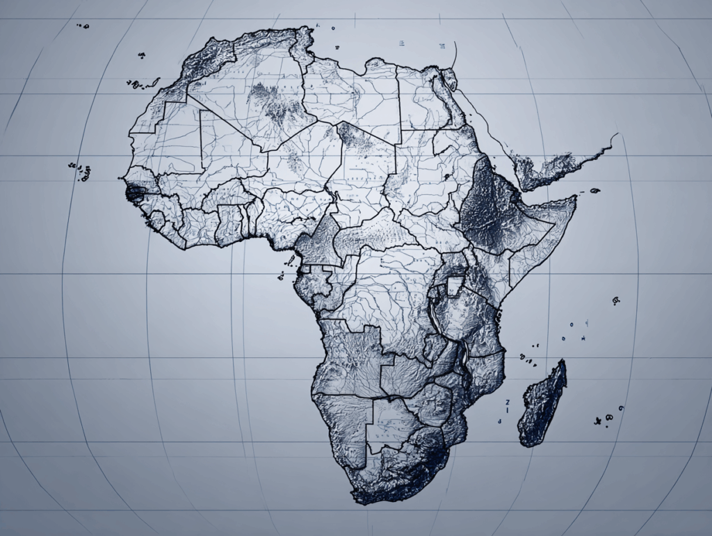
Africa and the True Size of the World
For many years, students have studied the world map using the Mercator projection. This map is easy for sailors because it shows straight lines for travel. But it makes some countries look much bigger or smaller than they really are. For example, Greenland looks almost the same size as Africa on the Mercator map. In truth, Africa is about 14 times larger!
Now, the African Union and many teachers want to change the map in schools. They say students should learn with maps that show the true size of countries. One example is the Equal Earth map. This map keeps the correct shapes and areas, so Africa, South America, and other regions appear closer to their real size.
Why is this important? Maps affect how people see the world. If Africa looks small, students may think it is less important. A more accurate map can help people understand global fairness and respect.
A new campaign called “Correct the Map” asks schools and governments to replace the Mercator map. Many people believe this change will help young people see the world more clearly and equally.
<音読用音声>
<Important Words>
★ projection : a way to draw the Earth on a flat map
★ sailor : a person who works on a ship
★ region : a large area of land
★ accurate : correct and true, not wrong
★ campaign : an organized action to reach a goal
★ fairness : the quality of being just and equal
★ respect : thinking someone or something is important
<日本語訳>アフリカと本当の世界の大きさ
長い間、生徒たちはメルカトル図法の世界地図で学んできました。この地図は、航海士にとっては便利です。直線で航路を示すことができるからです。しかし実際よりも国の大きさを大きく見せたり、小さく見せたりしてしまいます。例えば、メルカトル地図ではグリーンランドはアフリカとほぼ同じ大きさに見えますが、実際にはアフリカの方が約14倍も大きいのです。
今、アフリカ連合や多くの教師たちは、学校で使う地図を変えたいと考えています。子どもたちには、国々の本当の大きさを示す地図で学んでほしいのです。その一例がイコールアース地図です。この地図は形と面積を正しく保つため、アフリカや南アメリカなどが実際に近い大きさで描かれています。
なぜそれが大切なのでしょうか?地図は人々の世界の見方に影響します。もしアフリカが小さく見えたら、生徒たちはその重要性も小さいと考えてしまうかもしれません。より正確な地図は、公平さや尊重を理解する助けになります。
「Correct the Map」という新しいキャンペーンは、学校や政府にメルカトル地図を取り替えるよう求めています。多くの人々は、この変化が若者たちに世界をより正しく、平等に見る力を与えると信じています。